brad's blog
Too old for Tik-Tok. Too lazy for YouTube.
London Bridge, AZ
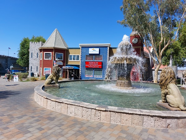
07/26/24 - Contrary to the popular nursery rhyme, London Bridge did not fall down. Would you believe it was disassembled and then rebuilt in Western Arizona? This version was built (completed) in 1931. As more and more autos starting using it, it became clear that this was not built to withstand that level of traffic. So in what seems odd to me is that the City of London put it up for sale to the highest bidder. That bidder was Robert McCulloch Sr. - the chainsaw guy and he paid $2,460,000 for it. A few years later, the reconstruction at Lake Havasu, AZ was completed with a total cost of just over 5 million dollars.
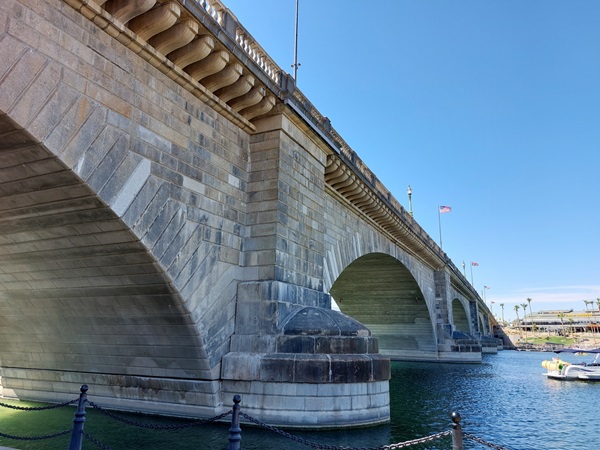
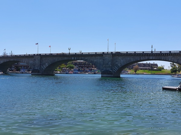
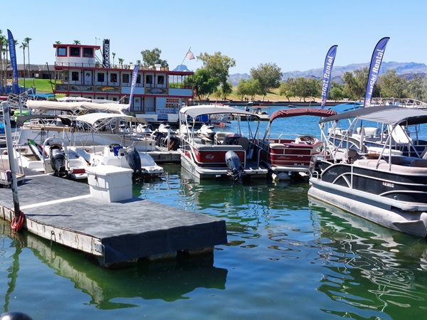
In some ways, there is nothing spectacular about the bridge itself. It's a handsome stone bridge that quietly does its job of allowing passage over a body of water. The stone arches are nice and has some nice detailing here and there, but at the end of the day - it's a bridge. It's the story that makes it something to see. There is an English Village with a visitor center/souvenir shop where you can find out more about the bridge and its story. Also in the village are several shops, some more "English" than others, but some nice options for shopping and dining. Of course there is the lake itself where you can launch your boat, rent a jet ski, and otherwise frolic in the water to escape the hot Arizona sun. I would not call this a must see, but if you find yourself on SR 95 in AZ, it is an interesting thing to see in person and a fascinating story of a man who may have had a little too much money and time!
Travel Gear - ETChg Kit
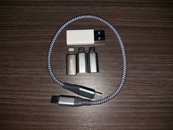
07/19/24 - For me, part of traveling successfully is having the right gear and remembering to pack it. To that end, I developed my Every Trip Charging Kit. It contains a 110v charger, a USB-C to USB-mini adapter, a USB-C to USB-micro adapter, a USB-C to Lightning adapter, a USB-A to USB-C adapter, and an 8" USB-C to USB-C cable. This suite of adapters covers every chargeable item I have plus the Lightning for any Applephile friends I am traveling with. All of these were Amazon finds. Most of my electronics are USB C, but there are a few older outliers using the micro and even the mini. The USB-A to USB-C is for the cases where I am not using my wall charger. As of this post, I have yet to use the micro adapter, but given the tiny size of it, it's a no brainer for me to add it to the kit (for now)
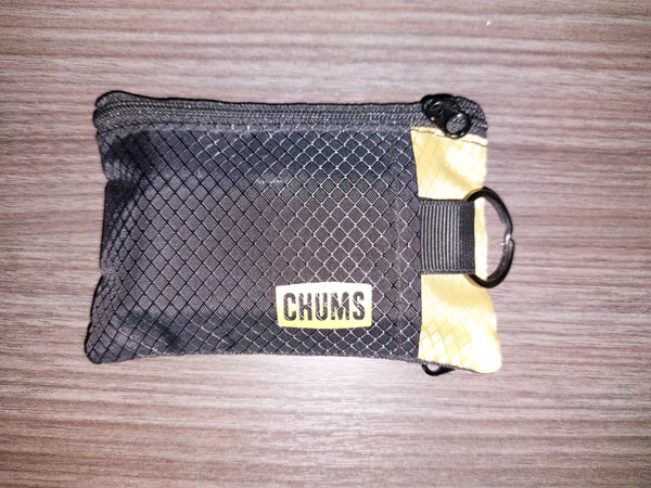
The charger is a Nomad 35W Slim Power Adapter. It is a USB-C to USB-C, one port adapter. The dimensions are 2 13/16 x 1 5/8 x 9/16 (excluding prongs) or 2 13/16 x 1 5/8 x 1 3/16 (including prongs). One of the features I wanted was folding prongs to prevent tearing or otherwise ill fitting in stuff sacks. The second feature was a for it to be a small as practical. Nomad offers a 65W adapter with USB-C and USB-A outputs, but my need to charge two things did not outweigh my desire to have the smallest possible charger. It is only marginally larger so it might be a better choice for you. I can take my Samsung Galaxy A52 5G from about 30% to fully charged in about under two hours so it's as fast as I need. The charger, paired with the adapters, stay in my Chums wallet and it stays in my travel box so I can grab it and go when I am taking any kind of trip. It's proven to be a winner so far. I'm using it as I type this as I sit in a hotel in Omaha.
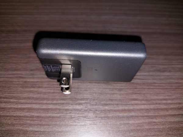
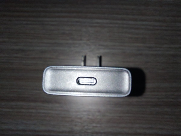
Chums Surfshorts Wallet
Nomad 35W USB-C Slim
Route 66 (part 3)
07/12/24 - I skipped over Kingman in my other two Route 66 posts because as the largest (and probably only) city along this stretch, it's deserving of a full post. The road changes into a divided 4 lane road as you enter from the east and go through the industrial areas. There are signs of live there, some industry and some convienence marts, along with the Kingman Airport, but this is not the part of the road I think they were singing about. As you get closer to town it becomes a 4 lane road that is no longer divided. You can see some chains, some old time places trying to hold on, and some newer places celebrating the famous road. At this point you might also notice that Route 66 is alternately called Andy Devine Avenue. Andy Devine was a character actor who's career spanned from 1926 to 1977. He's most well known for his work in westerns and to me as Link Appleyard in "The Man Who Shot Liberty Valance".
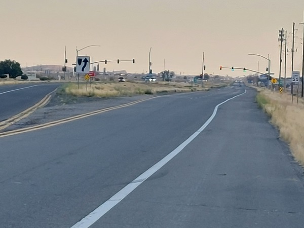
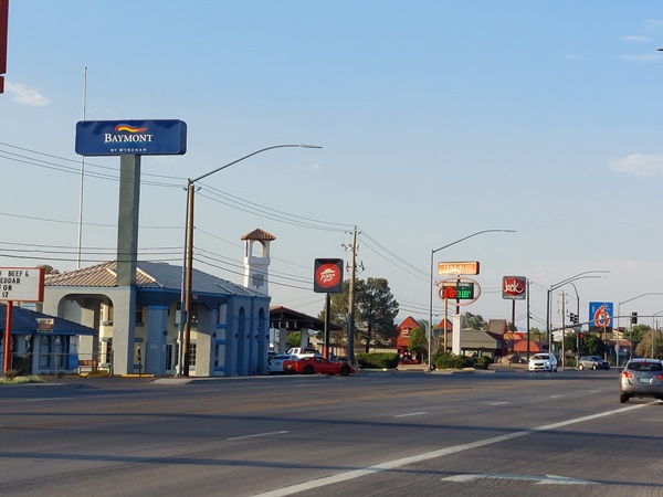
Compared to the other stops along the way, Kingman is the place to stop if you want to stock up on supplies. If you are headed west, turn right onto Stockton Hill Road and head toward and then past Route 40. Along with all kinds of fast food, you will find a Walmart, three grocery stores, some car dealers, hardware, drug stores, several banks, a hospital and to my mind some of the nicer places to stay along the trip. Further west from Stockman Avenue you can make a quick detour to Beale Street for some places to eat and shop that are more independant in flavor than the chains on Stockman. It also takes you directly to the Visitor Center, Gift Shop, and Museum and there is a place to take a picture of your car under the Route 66 sign. (Plus, there are restrooms). Across from the Visitor Center is Locomotive Park which has a static display of AT&SF steam engine #3759. And if trains are your thing, there is also a small but nice Railroad Museum and model railroading display in the Amtrak station just up the road.
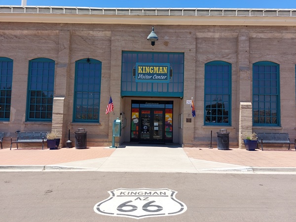
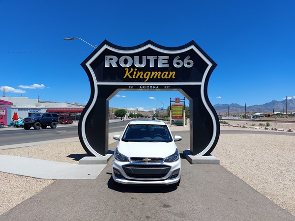
Depending on what you feel like doing, you could either drive right through or stop and stay for a couple days to explore. In addition to all of the offerings in town, there is a county park less than 30 minutes away that has cabins, RV sites, recreational area, hiking, and frisbee golf. There is also a chance that something is happening at the county fairgrounds that is right in town so that's something to look for. (at the time I am writing this, I cannot access their website, but a quick web search will find what you need in other articles or stories. And from June though October, downtown hosts First Fridays. The downtown businesses have special deals, activities, pop-out shops, etc. There are also food trucks and other booths/tents for local businesses not on Beale Street full time. Kingman is a pretty good place to stop for an hour or a few days while you are out getting your kicks on Route 66.
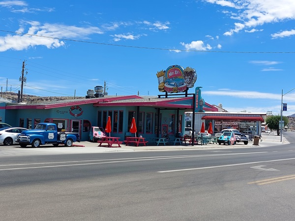
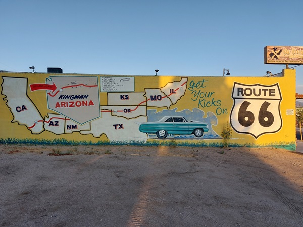
Andy Devine at IMDB
Locomotive Park
Kingman Historic District
Kingman Railroad Museum
Hualapai Mountain Park
First Fridays
Route 66 (part 2)
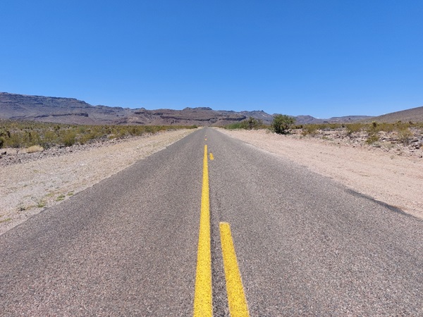
07/05/24 - Leaving Kingman, you continue along Route 66, but it does get a little dicey so pay attention to the signs. Once you leave the city, you are in a different kind of terrain. The high desert scrub is gone and you are in the land of sand. The road starts out straight and nondescript, but nearly every connecting road is a dirt road. There is some nice mountain scenery though and eventually you are driving through those mountains. Outside of the random houses here and there, there is not much to see. I revert back to thinking about the travelers in the 50's and how that must have felt before the era of cell phones. (I did mostly have a signal in this section).
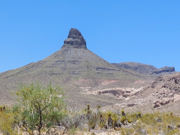
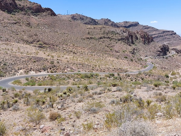
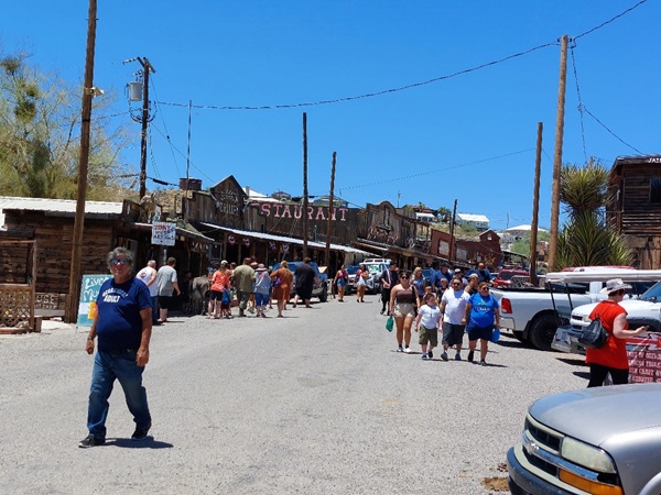
Further down Route 66, it turns into quite a curvy mountain road. Trucks are restricted due to the nature of the curves and the drop offs can be rather severe. There are some guardrails but many of the curves just have little to no shoulder and if you were to venture off, it would be quite a drop. But, if you take your time and drive appropriately for conditions, you'll be just fine. Eventually,you will come to the old mining town of Oatman. The Oatman of today reminds me of places like Jerome, AZ. The mines stopped producing in the 40's and then the interstate took the traffic away, so it reinvented itself as a tourist town. It has wooden sidewalks and some staged wild west shows along with a bunch of shops. There is a hotel with a full service restaurant and bar, but it no longer hosts overnight guests. And it has a few things that stand out to me. Free parking and public restrooms.
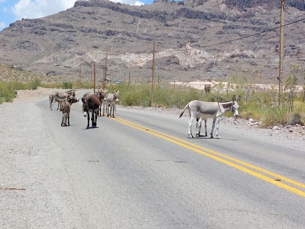
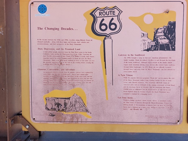
The Oatman area is known for its wild burros which are descendants of the old miners stock. It's not uncommon to see them in town and they are quite docile. In town, feeding them is encouraged. If you see them outside of town, you are asked not to feed them. I rolled down my car window to get a picture and they tried to put their heads in my car, I'm assuming for treats. They had traffic completely stopped for a bit. But if you are in a hurry, you picked the wrong road anyway so if you chill out, they will eventually move along. Out of Oatman, it's barren until you hit the Colorado river n Topock. As my route took me right to Route 40, I did not spend much time there. My next Route 66 trip may start there and proceed into California. Along the road there are several signs that tell the history of the route. They are worth the stop so check them out.
